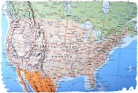
 Sharing Spatially with GeoPDFs
Using data and aerial imagery of a Stony Brook University campus (e.g., Stony Brook, Southampton or Manhattan) learn how to:
• Manipulate layers, attach files, add comments, apply stamps
• Search and display object attributes, and zoom to coordinates
• Measure distances and change geographic projections
• Hyperlink GeoPDF objects with other PDF documents, such as floor plans or text
• Manipulate layers, attach files, add comments, apply stamps
• Search and display object attributes, and zoom to coordinates
• Measure distances and change geographic projections
• Hyperlink GeoPDF objects with other PDF documents, such as floor plans or text
Monday, Sept. 22 @ 11:45 AM (2 hours)
Register @ http://www.stonybrook.edu/library/services/instruction/.
All workshops take place in classroom A in the Central Reading Room.
Additional sections of these and/or other workshops may be scheduled for any group of 5 or more. For more information click on the Library Instruction link at
www.stonybrook.edu/library or contact Janet Clarke, Head of Instruction, at 632-1217 or Janet.Clarke@stonybrook.edu.Janet Clarke
Associate Dean, Research & User Engagement at Stony Brook University Libraries
email: janet.clarke@stonybrook.edu
Latest posts by Janet Clarke (see all)
- Congratulations to Dr. Christine Fena on Receiving Tenure and Promotion to Associate Librarian - September 4, 2025
- Melville Library Galleria Glow-Up: More Seats, More Outlets, More Vibes! - February 5, 2025
- Library Galleria: Makeover Edition - December 3, 2024

